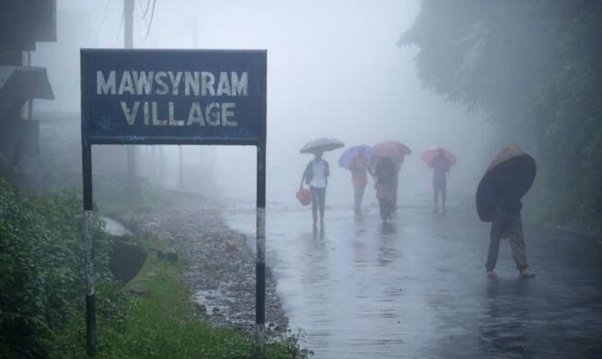
NEW DELHI, April 4 (IANS): Even as many places across India are witnessing severe to very severe heat waves, two places in Meghalaya have been receiving excessive rainfall of over 300 mm within a span of 24 hours, for the last 3-4 days.
But the extremely heavy rainfall in both Sohra (Cherrapunji) and Mawsynram is normal during this pre-monsoon period and there have been some exceptional days in the past when, in some cases, rainfall exceeded 400 mm in 24 hours.
The India Meteorology Department (IMD) records showed Sohra, also known as Cherrapunji, received 190 mm rainfall in 24 hours till 8.30 am on April 1, 360 mm on April 2, barely 2.6 mm on April 3 and again, 150 mm till 8.30 am on April 4.
Similarly, a nearby station Cherrapunji RKM recorded 140 mm rainfall on April 1; 370 mm rains on April 2; barely 4.3 mm on April 3 while the data for Monday was not yet available.
Mawsynram recorded 330 mm on April 1, 390 mm on April 2, barely 2.4 mm on April 3 while Monday’s data was not available.
The IMD terms rainfall between 64.5 to 115.5 mm as ‘heavy rain’; between ‘115.6 to 204.4 mm’ as ‘very heavy rain’, and anything above 204.4 mm as ‘extremely heavy rain’.
Incidentally, most other areas in Meghalaya too have been receiving heavy rainfall but it is only these two places that have been receiving bountiful rains. Rainfall recorded till 8.30 am on Monday for other places in Meghalaya includes: Anlarem – 410 mm, Mawjyrwat – 240 mm, Jowai – 200 mm, Mawphlang – 190 mm.
“These places – Mawsynram and Sohra – have a very typical shape of catchment area and presence of orographic features. The catchment is funnel shaped and opening towards south – facing Bay of Bengal – so whenever moisture-laden southerly winds are coming in lower level, they hit these places almost at 90 degrees and due to orographic lifting, these areas get enhanced rainfall,” explained Sunit Das from IMD Guwahati.
The IMD records have shown that Cherrapunji has received as much as 644.2 mm rainfall in the pre-monsoon season on April 16, 1990. In recent times, it was 420 mm on April 24, 2016 and 330 mm on April 27, 2017.
Under the influence of strong southwesterly winds from the Bay of Bengal to the north-eastern states at lower tropospheric levels, fairly widespread to widespread rainfall is very likely over Arunachal Pradesh, Assam-Meghalaya during the next five days and isolated to scattered rainfall over Nagaland, Manipur, Mizoram and Tripura during the next two days and reduction thereafter.
Isolated heavy rainfall is also likely over Arunachal Pradesh on Tuesday and over Assam-Meghalaya on April 5, 7 and 8 and over Sub-Himalayan West Bengal-Sikkim during April 5-7.


